 Kruger Lowveld Explorer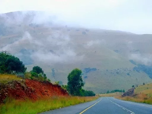
Skurweberg Pass
One picturesque route to drive from Machadodorp to Badplaas crosses the Skruweberg Pass. The Skurweberg Mountains, which translate to “rough mountain” in Afrikaans, are a group of historic sandstone outcrops. It is the remnants of the seafloor, at least 180 million years old, from the time of the extinct Super-Continent Gondwana.
Situated on the edge of the Drakensberg Escarpment, the Skurweberg Pass is a modern, asphalt, steep path over the Skurweberg Mountains. The pass’s curving layout makes it a favourite with motorcycle riders, albeit there are one or two bends that present a risk while travelling at high speeds. With a total drop of 448 metres, it has an average gradient of 1:17, making it relatively steep. Sadly, there are currently three problematic areas on the pass.
That’s where the road has receded. Drivers can still use the pass, but if they are unaware of the hazardous patches, it can be risky.
Because of the exceptional beauty of the Skurweberg, visitors use the Pass to take in the surrounding landscape as well as the route from Machadodorp to Badplaas. A hilly landscape including streams, waterfalls, pools, and overgrown kloofs is the Wathaba Wilderness landscape. This area is home to about ninety native tree species, lichens, ferns, and mosses.
The Komati River’s course forms a sizable Kloof through which the Pass winds. The Pass starts in the south, just north of Badplaas. The path huggs the mountain and gains altitude swiftly, making the initial ascent difficult.